Tuesday, May 25

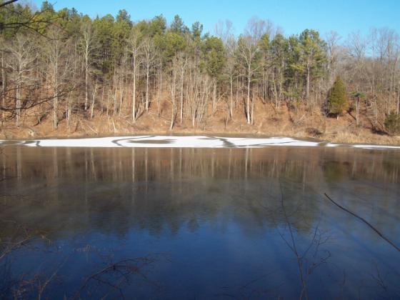
Rocky Bluff Trail


Continuing with our monthly series, "Adventures With Uncle Bob - Guide to Self-Adventures in Southern Illinois," we feature Rocky Bluff trail in Crab Orchard National Wildlife Refuge. This trail was previously described in the April, 2006, Shawnee Newsletter but was not posted to the website. Parking in this refuge requires a Crab Orchard $2 sticker, Golden Age or Golden Eagle pass. Stickers may be obtained at the office on Rt 148 south of rt 13, or at Devil's lake concessionaire (open in late spring).

Directions: From Carbondale, take Giant City Road several miles and look for Grassy Road. Turn left and drive 5 miles to the sign for Devil's Kitchen Lake. Turn right, and go to the "t" junction. Turn left, follow across the bridge to the parking area. For those coming from the south, take I-57 to Rt 148 exit. Turn west and travel approx 5 miles and Grassy Road is next to a utility substation and general store.

At the trailhead, note that this is a loop trail-go either way for 1.8 miles. Nice overlook over the canyon at the start. The tread on this trail is excellent and easy to moderate. Also note several benches to rest. We will take the top segment of the trail. The trail starts thru a pine plantation. At 0.18, note a connecting trail to make a short loop. Our trail continues gradually uphill for 0.29 and comes to a junction. Turn left onto this old road. Go 0.26 on this road to a junction with Turkey Trail and Rocky Bluff. Turn left again. Now we have frequent views into deep ravines (especially during leafoff). Note a cliff line on the right down in the valley. We will make a sharp descent on waterbars. The trail then ascends with more ravine views and a mess of downfalls from the May, 2009, wind storm.

Now we descend down stair steps and a handrail to a cliff line which continues for the rest of the loop. This line averages about 10-20 ft high and a creek parallels us on the right. Note the small cave and overhang. Near the end, note the circular cliff canyon and waterfall. The trail ascends to the trailhead via stair steps and handrail. GPS coordinates could not be found but for a reference to topo map USGS 1:24000 Crab Orchard lake. More info from Bob Tyson at 684-5643 or robkay43@webtv.net.

Friday, May 7

Wetland Blitz


Volunteers Needed to Inventory Wetlands in Southern Illinois

The Sierra Club is hosting a Wetland ID Blitz on Sat. June 5 from 9 am - 2 pm. The Blitz is part of a Sierra Club Water Sentinels and Ducks Unlimited partnership to update the National Wetland Inventory for Illinois. Meet at Longbranch Coffee House at 100 East Jackson Street, Carbondale, IL. Bring your digital camera and download cord. We'll train you and send you out to visit 8-10 wetlands in Jackson County. Then we'll meet back together to download photos and compile collected data over lunch. If you do not have a camera, don't let that be a reason not to participate. RSVP to Terri Treacy at terri.treacy@sierraclub.org or at 618-521-1030 by June 1.
We also need inventories done in other southern Illinois counties. So, if you’re interested in working in another county, please consider coming to the June 5 event in Jackson County to get trained and we’ll set you up with the materials you’ll need to work in the other counties on your own.

Project Background - The Wetland Blitz event is for volunteers wishing to visit wetlands in Illinois to help with the field verification for an update of the state's inventory of wetlands. Volunteers trained at the Jackson County Wetland Blitz will be qualified to gather inventory
data independently in counties throughout southern Illinois. Ducks Unlimited (DU) has received an Illinois State Wildlife Grant to update the National Wetlands Inventory for Illinois. For additional information on this project, see http://www.ducks.org/Conservation/GLARO/3752/GISNWIUpdate.html.

Using aerial photographs, DU is currently tracking the fate of wetlands included in Illinois' inventory from the 1980's. To check the accuracy of the photo review, a random 2% of the identified wetlands will require field verification. It is estimated that 6000 wetlands throughout Illinois will need to be visited during 2009 and 2010 to complete the inventory. Volunteers will
be trained to recognize different classes of wetlands. Wetlands which need a field verification will be located close to a road to minimize access issues. A sheet with a map to the site and an aerial photo will be provided on which the type of wetland or its conversion to agriculture, recreation or development will be indicated. Volunteers will also be asked to take and provide a digital photo of the wetland.

Volunteers interested in helping with this important wetland protection project are asked to RSVP to Terri Treacy, Sierra Club Illinois Chapter Conservation Field Staff at terri.treacy@sierraclub.org.

Sunday, April 25

Southern Illinois WeedWatch


Volunteers Needed for the Southern Illinois WeedWatch Project

Invasive plant species can aggressively overtake or displace native species causing a drastic reduction in our native biodiversity and natural beauty. Discovering weeds before they become well-established is critical to reducing damage to ecosystem integrity, preventing the loss of habitat for rare plants and animals, and preventing costly natural resource management. WeedWatch volunteers will learn to identify, locate and map invasive species within Illinois Natural Area Inventory sites that are located in Wilderness Areas in the Shawnee National Forest.

Will you become an Illinois WeedWatch Project Volunteer?
Volunteers will be trained to:
• identify invasive plant species in southernmost Illinois.
• map their locations using Global Positioning System (GPS).
• record data online into a web-based database.
Volunteers will:
• deepen their understanding of the natural world.
• play an important role in the protection of the unique resources in southernmost Illinois.
• aid land managers to effectively slow the spread of harmful invasive species.
• contribute to the comprehensive regional database of non-native invasive species locations.
Volunteers will agree to:
• attend 2-hour plant ID training on May 5 from 6 to 8 pm at Giant City State Park.
• work in at least one target Natural Area over the summer.
• have fun!

Attention Students!! Earn Saluki Volunteer Corps hours!!

Interested, but can’t make the May 5 date? No problem, contact Terri to discuss other options.

Contact Terri Treacy at 618-521-1030 or terri.treacy@sierraclub.org by April 30.

Tuesday, April 20

Max Creek Trail


Continuing with our monthly series, "Adventures With Uncle Bob-Guide to Self-Adventure in Southern Illinois," we feature Max Creek trail. Directions: From Marion,IL, take I-24 to Tunnel Hill exit and follow the road thru Tunnel Hill to US 45. Turn right on 45 and drive a few miles and look for Taylor Ridge Rd (just past a church). Turn left and follow about 3 miles to its end and River to River trail head. There is enough room to park a horse trailer. The last mile of this road leaves something to be desired-avoid it if there has been frequent rains or else have a high clearance vehicle. There is confusion here as the R-R trail has been re-routed but blue blazes on the trees go both north and east. Follow east with the Forest Service number 1737-the R-R hikers use this one anyway. I have not explored the north segment yet. I understand it to be shorter, more scenic, but has 3 creek crossings.

Trail 1737 is an old roadbed thru pine plantations and many downfalls are over the trail. After 40 minutes, we arrive at the top of a bluff line and turn right, switch-backing downhill to the creek. This is a pretty and deep canyon with a long cliff line on both sides. Cross the creek. If you want to see a 60 ft waterfall, go right and bushwhack past 2 large free-standing boulders and head for the base of the cliffs. There was only a thin stream over the cliff on Feb. 15. Back at the creek crossing, a significant number of people have experienced a vortex; manifestations include external air pressure within or against your body, optical illusions, and earth tremors. Turn left at the creek, and follow the R-R trail uphill and travel thru the woods until it ends on a blacktop road. You could make a car shuttle out of this hike. park either on the side of the road, or go uphill to a spot near a chain link fence. GPS coordinates here are 37 29' 39"N and 88 47' 31"W. If you parked here, just go left and drive 1.5 miles to the Tunnel Hill-Simpson blacktop. Turn left, and go approx 3 miles to its junction with US 45.

To clarify the approach from the east end of the hike, cite the junction at Rt 45 and Tunnel hill rd. Go straight ahead (south) as it becomes Gilead Church Rd. Go approx 3 miles to a settlement and a right on Hilltop Lane. Take this 1.5 miles, following the R-R signs. The trail head is obvious. Signage on the trail is good. At one point on the trail, look for four posts and turn left. later we cross 2 narrow stream beds and cascades. Soon we are ready to descend to Max Creek. This means a left turn at the sign. Pay attention as another unnamed trail continues straight ahead. On 3-23-10, the waterfall was dry but the creek was a deep, wide stream. While in this area, why not go the Cedar Wonders North trail-scroll this blog index for info. If you have been following this blogsite, Max Creek is the last link to complete the River to River Trail from Peter Cave junction near Eddyville to Dutchman Lake. More info from Bob Tyson at 684-5643 or robkay43@webtv.net. For more photos, visit http://community.webshots.com/user/river2riverhiker and search for Max Creek.

Monday, March 29

Iron Mountain Trail


Continuing with our monthly series, "Adventures With Uncle Bob-Guide to Self-Adventure in Southern Illinois," we feature Iron Mountain trail in Shawnee National forest. This trail was described in the Sierra newsletter Sept, 2006 but did not get posted to the website or lost. Here it is again.
Directions: from Alto Pass, IL, continue south on rt 127 and turn left onto Mt Glen rd (sign for Walnut Grove church). Proceed a couple miles to turn right on Kaolin Road. Follow this to a right turn on kaolin Pit lane. Follow to next right turn and parking lot.
Note the large pond surrounded by ravines. This used to be a mining area for kaolin clay and a company town. After the resource was depleted, it was turned into a fishing pond. Books show a loop trail starting with the overlook near the parking lot. As of this date in January, 2010, that trail segment fizzles out after a quarter mile. The Forest Service plans to reconstruct it this spring. Instead, backtrack east down the road to the white cross and commence this trail segment to the top of the 700 ft mountain. Most of this is a gradual climb and while there are no FS trail signs, the tread seems clear. Note the 1889 ornamental grave stone along the climb. As we ascend, note the deep ravines on both sides of the trail. Near the top, the trail is steep for 100 ft. Now we reach a "T" junction with a north-south trail. Go left (mark this junction so you can find it on the way back). Enjoy the ridgetop views over surrounding valleys and six wildlife pond pits as you travel.
Come to a junction. Turning right brings us to a boundary with Myers Ranch farm -"welcome to pass thru, not responsible for accidents." Note the picnic table in the middle of the trail. Come back to the junction and turn left for more views. Another side trail noted with a sign for Myers horse loop. Pass by an old house foundation from the 1930s. Eventually the trail starts descending into thick woods. I retraced the route back to the car and estimate 1.4 miles from the parking lot to the summit. Another road access to the summit trail is off rt 127. Instead of turning onto Mt Glen Rd, continue past the bridge to an unmarked left turn onto a steep gravel road (FS 606). It is no longer maintained and often deeply rutted. You may need a high clearance vehicle for this. GPS coordinates are N 37.516161 and W 89.311754. More information from Bob Tyson at 684-5643 or robkay43@webtv.net. 10/01/11: the loop is more clear now.hiking past the picnic tables,going up the hill,the trail is headed north. Along the way,look carefully for a left turn where you follow to the top.this used to be blocked by vegetation. Miss this turn and you will continue straight on and will fizzle out.

Thursday, February 25

Hitching Post Trailhead


Continuing with our monthly series,"Adventures With Uncle Bob-guide to Self-Adventure in Southern Illinois," we feature the River to River trail section (trail 001) between Herod, IL and Garden of the Gods. This description will start near Herod, although you can embark either way. Directions: From Harrisburg, take Rt 145 south to Rt 34 and follow to Herod. Near the post office turn left onto the blacktop and travel uphill approx 1.5 miles to the well-maintained Hitching Post parking lot (on the left). It is not signed from the road so watch closely. There is plenty of room for horse trailers. Cross the road and commence the hike. This stretch of Shawnee National forest wilderness area is 5.8 miles.

The trail starts out as a FS fire lane and soon becomes a backbone trail with deep ravines on both sides. We come to a junction with #00lE. Go straight ahead or else you will be going in a circle. Later we find ourselves along a beautiful two-layered cliff line. After that, the trail gets more rugged as it ascends via switchbacks. We finally level out on a steep ridgetop and the trail thru the woods is clearly defined. Be on the lookout for at least four places where one can step off the trail onto rock glades for unimpeded overlooks over the valley and adjacent ridgetops. If you went no further than this point, the hike would be worthwhile. Approx GPS reading here is 37 36' 30"N and 88 24' 0"W. we have hiked about 2.5 miles at the best overlook.

We start a long descent and, at the valley floor, please note the trail junction sign. By now your sense of direction has diminished. Trail 001 points to G.O.G. and Herod. We can continue on #001 but there is a more scenic connecting trail (152A) which will eventually meet back up with #001. While trail 152A is not easy to follow during leafoff, you are rewarded with a tall cliff line on both sides of the trail in a narrow corridor. At some point we rejoin #001 and enjoy views of the cliffs below the main observation trail. Note an "H" shaped window arch about 50 ft up the cliff. As we continue on, you will note forks in the trail to either ascend to the Garden of Gods parking area or continue on to the backpacker parking lot. As of this writing on Nov 24, 2009, the trail was not muddy and suggests that views are optimal during leafoff.

If readers plan a group outing on this trail, regulations limit the group to 10 people or horses. This trail runs thru a designated wilderness area in Shawnee National Forest. For any questions, contact Bob Tyson at 618-684-5643 or robkay43@webtv.net. You may also contact John O'Dell at 618-252-6789.

Monday, January 25

South Atwood Ridge Trail


Continuing with our monthly series, "Adventures With Uncle Bob-Guide to Self-Adventures in Southern Illinois," we feature Atwood Ridge in Shawnee national Forest. Directions: From Jonesboro, IL, take Rt 127 south for approx 4 miles to turn right on Old Cape Plank road. Go 4 miles on this road as it gives way from farm land to forest. It becomes a canyon road thru deep ravines. This is worth the drive even without doing the trail. Look for a sign on the road which reads Trail 264A/1050E. Turn right and at a split, turn right again and start an ascent on this one lane gravel road. Note a parking lot as well as room for 3 cars opposite it (in case the lot is muddy). We will be walking on this gravel lane the whole distance.

From here the road makes a steep ascent. You can also avoid this first ascent by driving up further to some solid shoulder roadside parking just past the bushes lining the road. The road levels off here and there while continuing to ascend this mountain. Note the deep ravines on both sides as you continue to climb. There are frequent points where you can see distant ridgetops and valleys. Near the end, the road descends and then back up again to its end and space to turn around. I noted a narrow dirt trail continuing from here and without any information, walked a short distance without noting anything of significance. The Forest Service knew nothing of the latter. They indicate that this road was built to augment the logging industry and have no other plans for it.

This outing is best during leaf-off or when fall colors come out. More info from Bob Tyson at 684-5643 or robkay43@webtv.net. While here, why not also drive over to Hamburg Hill Trail on Plank road. Information is on this blog as well as the website: http://illinois.sierraclub.org/shawnee/unclebob/adventures.htm.