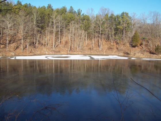
Max Creek Trail


Continuing with our monthly series, "Adventures With Uncle Bob-Guide to Self-Adventure in Southern Illinois," we feature Max Creek trail. Directions: From Marion,IL, take I-24 to Tunnel Hill exit and follow the road thru Tunnel Hill to US 45. Turn right on 45 and drive a few miles and look for Taylor Ridge Rd (just past a church). Turn left and follow about 3 miles to its end and River to River trail head. There is enough room to park a horse trailer. The last mile of this road leaves something to be desired-avoid it if there has been frequent rains or else have a high clearance vehicle. There is confusion here as the R-R trail has been re-routed but blue blazes on the trees go both north and east. Follow east with the Forest Service number 1737-the R-R hikers use this one anyway. I have not explored the north segment yet. I understand it to be shorter, more scenic, but has 3 creek crossings.
Trail 1737 is an old roadbed thru pine plantations and many downfalls are over the trail. After 40 minutes, we arrive at the top of a bluff line and turn right, switch-backing downhill to the creek. This is a pretty and deep canyon with a long cliff line on both sides. Cross the creek. If you want to see a 60 ft waterfall, go right and bushwhack past 2 large free-standing boulders and head for the base of the cliffs. There was only a thin stream over the cliff on Feb. 15. Back at the creek crossing, a significant number of people have experienced a vortex; manifestations include external air pressure within or against your body, optical illusions, and earth tremors. Turn left at the creek, and follow the R-R trail uphill and travel thru the woods until it ends on a blacktop road. You could make a car shuttle out of this hike. park either on the side of the road, or go uphill to a spot near a chain link fence. GPS coordinates here are 37 29' 39"N and 88 47' 31"W. If you parked here, just go left and drive 1.5 miles to the Tunnel Hill-Simpson blacktop. Turn left, and go approx 3 miles to its junction with US 45.
To clarify the approach from the east end of the hike, cite the junction at Rt 45 and Tunnel hill rd. Go straight ahead (south) as it becomes Gilead Church Rd. Go approx 3 miles to a settlement and a right on Hilltop Lane. Take this 1.5 miles, following the R-R signs. The trail head is obvious. Signage on the trail is good. At one point on the trail, look for four posts and turn left. later we cross 2 narrow stream beds and cascades. Soon we are ready to descend to Max Creek. This means a left turn at the sign. Pay attention as another unnamed trail continues straight ahead. On 3-23-10, the waterfall was dry but the creek was a deep, wide stream. While in this area, why not go the Cedar Wonders North trail-scroll this blog index for info. If you have been following this blogsite, Max Creek is the last link to complete the River to River Trail from Peter Cave junction near Eddyville to Dutchman Lake. More info from Bob Tyson at 684-5643 or robkay43@webtv.net. For more photos, visit http://community.webshots.com/user/river2riverhiker and search for Max Creek.